We run it back and divulge the deets on what the upcoming 2025-2026 winter may look like for Oregon & Washington in terms of snow totals and ski quality.

Winter 2025-2026 Outlook for the Pacific Northwest
Note! This article is printer-friendly and can easily be made into a PDF. Just open the “Print” dialog in your browser and find the “Save to PDF” option.
Table of Contents (click to jump ahead)
- Introduction
- Recap of '24-25
- General Outlook for '25-26
- First Turns of the '25-26 Season: October 27
- Whistling in the Dark
- It's still fall, y'all
- Winter makes its grand appearance
- Take another little piece of my heart
Introduction
In this article, we attempt a layperson's description of what the upcoming winter season might look like from the perspective of backcountry ski/splitboard touring.
We encourage you to check out last year's (2024-2025) outlook article for good general tips on staying informed as winter develops. For brevity, we will not include them here again.
A Recap of Last Winter (2024-2025)
Winter 2024-2025 can be characterized, from a season-wide snowpack depth perspective, as about average. Below is a month-by-month description of how it unfolded.
- December was a phenomenal month for ski touring.
- January was interesting, in a way. Lamentably, not a single snow grain fell from the sky on Mt. Hood from January 1 to January 31, 2025.
- February came with a bang and gave us great mid-winter powder days. It was not without turmoil, however, as we experienced two massive atmospheric river events.
- March continued where February left off and delivered several cold storms. We had an excellent AIARE 2 course during a serious avalanche cycle.
- April saw the standard transition take place in which high pressure returned and the snowpack transitioned to an isothermal regime.
General Outlook for '25-26
La Niña piñata
As mentioned in last year's article, La Niña in the PNW tends to produce normal to below average temperatures with above average precipitation. This season is expected to have a weak La Niña with its effects washing out by the turn of the year.
What this means in practice is that there are no indicators to suggest that the season will be anything but average, with a very, very slight bias towards being slightly better than last season. This is good news for folks who like to recreate in the snow!
Ski quality
Last year's outlook (as well as all available contemporaneous modeling) failed to predict the month-long drought which occurred in January. But with a seasonal forecast that expects roundabout average temperatures and precipitation, we expect normal ski conditions to apply.
In the PNW, this means:
- Mostly warm-snow storms (think 32° F @ 4,000’ – decent skiing)
- Atmospheric river events (think 42° F @ 4,000’ – poor skiing)
- Occasional cold-snow storms (think 22° F @ 4,000’ – Sickter on the Richter)
Expect a preponderance of warm snow events, a few atmospheric rivers, and
2-3 cold snow events. When the forecast calls for a big storm with
temps below 25 F, try to capitalize and get out and enjoy it!
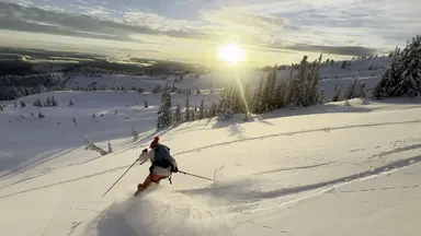
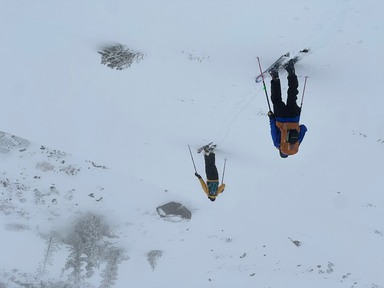
First Turns of the '25-26 Season: October 27
Timing & snow instability
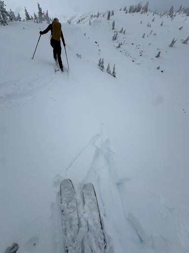
Just like last year, we found skiable snow on Mt. Hood in late October. We also found generally stable snow except for on the lee sides of ridges - there, we encountered 10-25cm wind slabs which were reactive, meaning that we humans could easily trigger them and there were several natural releases observed.
The snow that we skied is actively ablating in response to warmer temperatures and a lack of new snow. The forecast seems to suggest that we will experience sporadic high-elevation rain for the next week or so. After that, we hope to see successive, base-building storms!
A plug for the past
We encourage you to check out our seasonal outlook from last year to read about staying informed as winter develops - there are some great tips in there.
Whistling in the Dark
“Strange how people who suffer together have stronger connections than people who are most content”
— Bob Dylan, "Brownsville Girl" (1986)
Typically we're out skiing regularly by now but It's been a meager start here in Oregon as it has been for nearly all of North America. While we await the rills and rolls of regular successive storms, we encourage you to keep your skills sharp and your senses sharper. Crack open the mapping solution of your choice and re-remember what it's like to plan a ski tour, or perhaps a tour of another kind...
Consternation prize
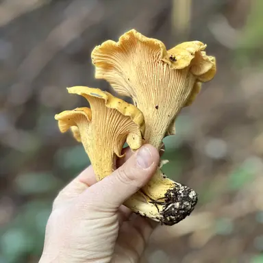
We've had moisture but we haven't had cold. While that's not great for snowpack development, it's pretty nice if you're “psyched on the myc’”, if you know what we mean. Mushroom season has been splendid here in the NW and on Mt. Hood in particular and it turns out that many of the skills you learn as a backcountry skier/splitboarder have good transferability to mushroom foraging.
Just like when planning a backcountry ski tour, we look at aspect and elevation to guide our field location choices for mushroom stuff. While avalanches obviously aren't a concern, maintaining awareness is still prudent as other mammals may be around stocking up for winter, too. It's also a good opportunity to get more familiar with your local tree situation. It turns out that oyster mushrooms love Pacific Silver Fir... which is generally pretty good tree skiing, too!
Hey, if we can't ski, at least we can eat well. Just remember to employ Leave No Trace principles while you're out gathering food. And maybe stop and do a snow dance every time you harvest a chanterelle.
It's still fall, y'all
We have been quite fortunate the past few years in getting to enjoy a fully-developed snowpack base by early December. This year, our debt has come due and, as of December 9, 2025, we're hurting for snow.
The main problem has not been one of moisture but rather of temperature. Our region has received tens of inches of water in December so far but it's been generally too warm to fall as snow at the elevations at which we commonly recreate.
Here's a quick look back at the last 10 years of snowpack data on key dates @ ≈5,400” on Mt. Hood.
| Season ↓ | December 9 | January 15 | March 15 |
|---|---|---|---|
| 2025-2026 | 0” | – TBD – | – TBD – |
| 2024-2025 | 48” | 88” | 120” |
| 2023-2024 | 29” | 88” | 132” |
| 2022-2023 | 55” | 70” | 131” |
| 2021-2022 | 2” | 87” | 104” |
| 2020-2021 | 37” | 77” | 157” |
| 2019-2020 | 9” | 98” | 113” |
| 2018-2019 | 17” | 62” | 121” |
| 2017-2018 | 24” | 42” | 109” |
| 2016-2017 | 53” | 82” | 125” |
The only clear pattern is that there is no pattern. So take solace if you're hoping for a good winter; the odds are that it will happen and fairly soon! That said, put your hands together, point ‘em skyward, and start dancing for snow.
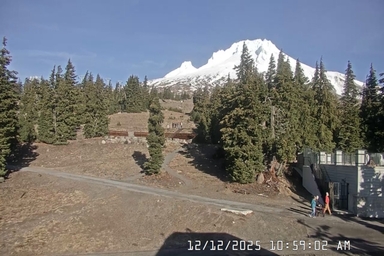
Winter makes its grand appearance
With snow chasing rain chasing snow chasing rain, it was a battle between good (snow) and evil (rain) that echoed of the classics of antiquity. Finally, snow won out and looks to stay for a nice while.
We had a nice low density base laid down to take us into the weekend. It was enough to get Timberline Lodge operating a single lift. Mt. Hood Meadows looks to open this week, as well. These are good bellwhethers for the backcountry.
With bits and bobs of snow and light rain this week (Dec 22-26), the forecast looks to take a turn for the very snowy, ushering in the new year.
We've had to make some tough calls this December in terms of reschedules but our north star throughout has been the experience of our participants. We wish everyone a season of happy holidays and a wondrous, snow-filled New Year!
We will likely temper the updates to this page now it looks like we have a
snowpack established and growing.
Take another little piece of my heart
Another January, another drought. It's well-known, common local knowledge that our region typically experiences a two-week drought each winter, typically either in the front half of February or the back half of January. This winter, however, is the second in a row with an extremely dry January.
As of February 7, finally, this drought is ending with high-elevation rain. The forecast ahead is mixed but we hope winter visits us again and stays for a while. This season has defied expectations, generally to the detriment of fun and pow.
This article was written & posted on October 30, 2025. We may update this article as key meteorological events occur! It was most recently updated on February 7, 2026.


Wylark® is a registered trademark of Wylark Mountaineering LLC.